Aharon's Jewish Books and Judaica
600 South Holly Street Suite 103
Denver, Colorado 80246
303-322-7345
800-860-8660 |
|
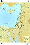 Biblical & Modern Day Map of Israel Biblical & Modern Day Map of Israel 
A Highly Detailed Cartographer's Map of Modern and Ancient Israel in Full Color
A highly detailed cartographer's map of modern and ancient Israel,produced in full-color. Featuring biblical and modern sites; archeological sites; topographical features; including mountains wadis & arid areas. It has extensive markings of cities, towns, and villages, and includes the entire region with amazing clarity. This map is "unfettered" by modern day political borders. Suitable for framing Size 36" high x 24" wide. |
 Biblical & Modern Day Map of Israel (Laminated) Biblical & Modern Day Map of Israel (Laminated) 
A Highly Detailed Cartographer's Map of Modern and Ancient Israel in Full Color
A highly detailed cartographer's map of modern and ancient Israel,produced in full-color. Featuring biblical and modern sites; archeological sites; topographical features; including mountains wadis & arid areas. It has extensive markings of cities, towns, and villages, and includes the entire region with amazing clarity. This map is "unfettered" by modern day political borders. Suitable for framing Size 36" high x 24" wide |
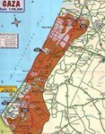 Israel Disengagement Map Israel Disengagement Map 
Set of 3 Maps Clarifying the Disengagement
With this detailed map, you can now begin to understand the news from Israel. New and Palestinian autonomous areas, the security fence, making of potentially dangerous roads and junctions, IDF road blocks, emergency centers, fire and rescue stations, IDF medical clinics, Israeli Police Stations. Israeli District Coordination Offices, all included on these 3 maps. |
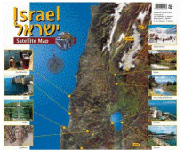 Israel From Space (MAP) Israel From Space (MAP) 
High-Quality Wall Map of Israel
This spectacular image is printed on high quality paper 35 x 100 cm. in size (Approximately 14 x 40 inches). Although Israel is a small country, it is very diverse and it shows well on this image. In that map you can clearly see different topographical features like mountain ranges, river channels, craters in the desert, etc. Major cities and Israel's borders are marked on the map in Hebrew and English. Made In Israel
|
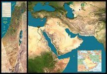 Middle East From Space Middle East From Space 
3 Maps Composed of Satellite Images of the Middle East
This satellite map is composed of several satellite images that were acquired by Landsat 7 at an altitude of 705 kilometers and were processed by computer. |
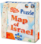 Map of Israel Puzzle Map of Israel Puzzle 
Educating and Fun Map of Israel Puzzle with Bonus free Israel Poster!
What a great way to Learn the Geography of Israel. After completing this gorgeous big puzzle you will have no problem recognizing where Jerusalem is and you will no longer confuse the Dead Sea with the Red Sea. Plus you will know the names of many of the famous Biblical places such and the City of Jericho and the home of Abraham in Beersheba. You will see Hebron and Massada and well as Eilat and Tiberias. |
 Biblical & Modern Day Map of Israel
  Biblical & Modern Day Map of Israel (Laminated)
  Israel Disengagement Map
  Israel From Space (MAP)
  Middle East From Space
  Map of Israel Puzzle
No comments:
Post a Comment